Why the Aerial Perspective is Revolutionizing the Real Estate Market
In the era of digital property presentation, traditional interior photos are often not enough to capture the attention of a demanding client. Buyers look for context – they want to know how the house looks against its surroundings, how large the plot is, and how far it is to the nearest park or access road. Drone photos and videos offer a unique perspective that cannot be replicated from the ground. At GRAFOTO in Wrocław, we see every day how aerial shots transform the perception of listings. But does every property really need a drone?
When Are Drone Photos and Videos an Absolute Must?
Investing in professional drone shots yields the highest return in specific market segments. Here are the situations where skipping the bird's-eye view can drastically reduce interest in a listing:
- Building and investment plots: Showing the boundaries of a plot, its shape, and the topography from above is the only way for a client to assess the land's potential without leaving home. In Lower Silesia, where demand for plots near Wrocław (e.g., around Miękinia, Kobierzyce, or Długołęka) is enormous, such shots make a listing stand out in seconds.
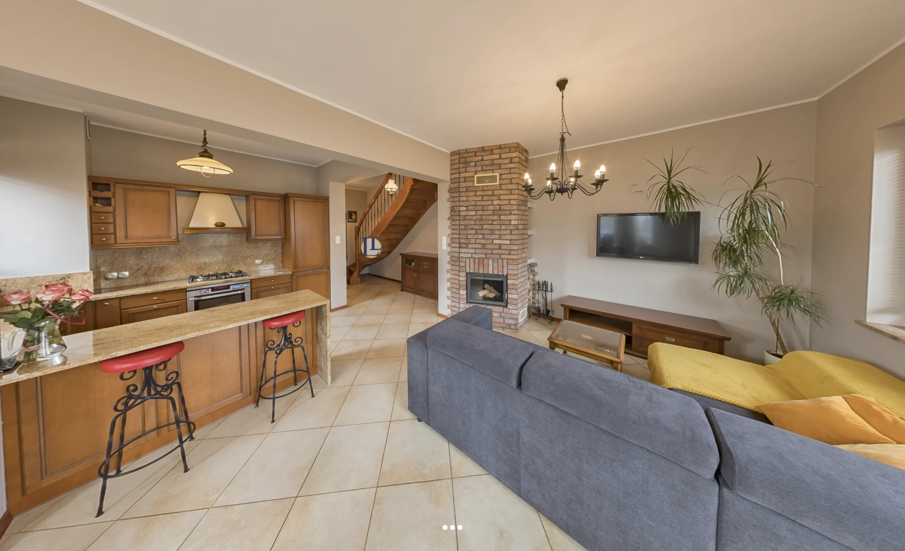
- Single-family homes and estates: A drone allows you to showcase the building's structure, the condition of the roof, and above all, the garden landscaping and neighborhood. It shows the home's relationship with its surroundings – the proximity of a forest, river, or other buildings in prestigious Wrocław neighborhoods such as Oporów, Krzyki, or Karłowice.
- Development projects: Developers building townhouse estates or modern apartment buildings use drones to show the progress of construction, the development's connection to the city center, and the distance to key commercial and educational infrastructure.
Comparison: Traditional Photos vs. Drone Photos
To better illustrate the profitability of this investment, it is worth comparing both forms of presentation. Ground-level photos perfectly showcase the standard of interior finishing, architectural details, and the coziness of the rooms. On the other hand, aerial shots build spatial context. They show how the property functions within its surroundings. For a client buying a house near Wrocław, knowing that the plot directly borders a forest or that no new noisy road will be built nearby is worth hundreds of thousands of zlotys. A drone provides this proof instantly, eliminating doubts at an early stage of browsing the listing.
When Will a Drone Not Bring the Expected Profit? Honest Expert Advice
As visual marketing specialists from Wrocław, we always advise our clients on solutions tailored to their budget and actual needs. Drone photos may turn out to be an unnecessary expense for small apartments in dense, historic areas (e.g., Wrocław's Nadodrze or Przedmieście Oławskie). If the view from above only shows the roofs of neighboring tenements or a well-like courtyard, it is better to invest those funds in a professional 3D virtual tour or precise interior home staging.
How Do Aerial Shots Influence Purchasing Decisions?
The human brain processes images much faster than text. Dynamic drone video, combined with a smooth transition into the home's interior (so-called hybrid shots), evokes strong emotions. It allows potential buyers to feel the space and the prestige of a given location. At GRAFOTO, we combine drone footage with graphics overlaid on the video (so-called motion tracking), which allows us to precisely mark plot boundaries directly on the film. This is a key tool that helps the end client easily understand the offer.
Rules for Safe and Legal Flights over Wrocław
Taking professional aerial photos is not just a matter of having the equipment, but above all, aviation law. Wrocław and its surroundings include controlled airport zones (CTR Wrocław-Strachowice) as well as numerous military or government zones. Conducting safe flights requires having the appropriate permits and pilot competency certificates (compliant with EASA regulations), registering every flight in the PANSA system, and having pilot liability insurance.
By choosing GRAFOTO, you can be sure that all shots are taken fully legally, safely, and in accordance with procedures, which eliminates the risk of severe financial penalties for the agent or property owner.
FAQ
Do I need to prepare the plot or house before a drone session?
Yes, proper preparation of the area is key. You should mow the lawn, put away garden tools, children's toys, and cars from the driveway, and close the entrance gate. From above, every single detail is visible, which can disrupt the aesthetics of the shot.
How long does a photo and video session with a drone take?
The aerial session itself usually lasts from 45 to 90 minutes, depending on the size of the area and the complexity of the airspace. Matching the time of day for lighting is key – the so-called golden hour works best.
Can you fly a drone in the rain or strong winds?
No, safety is the priority. Strong winds (above 10-12 m/s), rain, snow, or thick fog make safe flight impossible and drastically degrade image quality. In case of bad weather in Wrocław and the surrounding areas, we reschedule the session to the nearest sunny day free of charge.